
M2® Airborne Radar Technology
Non-Invasive Geophysical Prospecting Technology
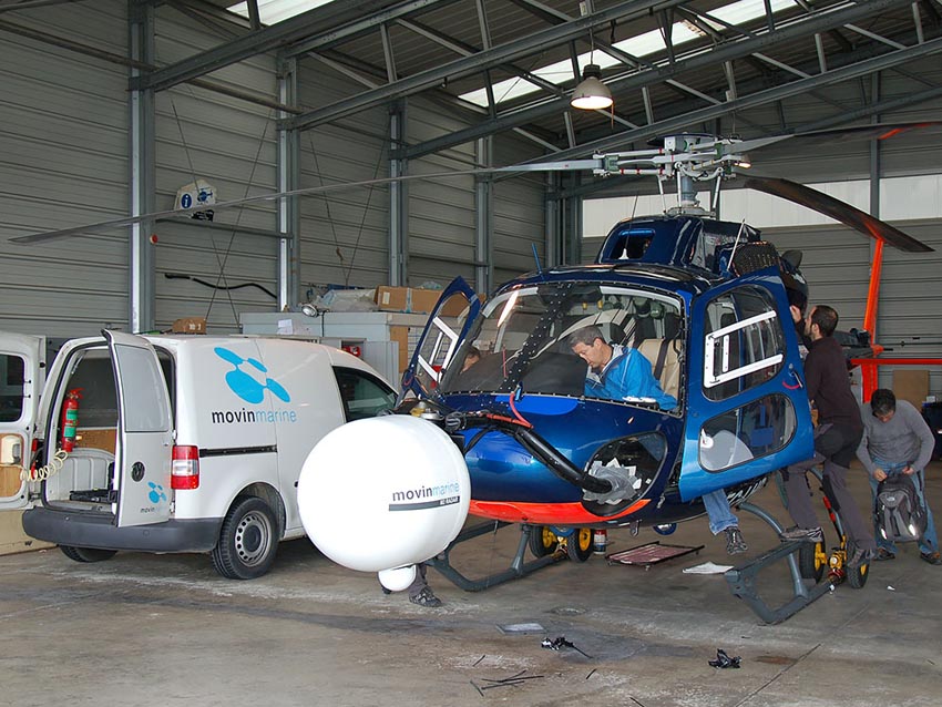
The M2® Airborne Radar is a passive remote sensing and geophysical prospecting system developed by Movin’Marine for advanced mineral, energy and archaeological exploration.
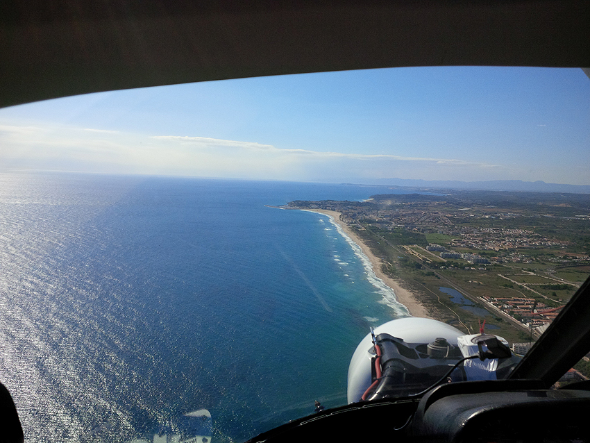
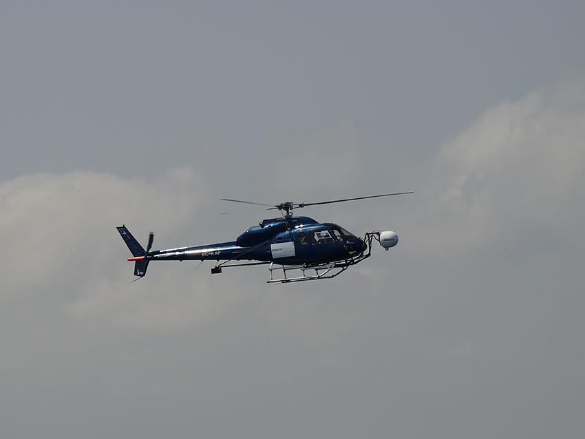
Designed to operate from helicopters or fixed-wing aircraft, the system integrates multiple passive microwave sensors, a thermal imaging camera, and high-precision positioning systems to measure subsurface emissivity and reflectivity without drilling or direct ground intervention.
This technology enables large-scale, rapid data acquisition while maintaining minimal environmental impact.
What Is the M2® Airborne Radar?
The M2® Airborne Radar integrates a set of passive sensors that detect naturally emitted or reflected electromagnetic energy from the Earth’s surface and geological formations.
Unlike active radar systems that transmit signals and measure their echoes, the M2® system does not emit its own radiation. Instead, it analyzes variations in natural radiation — including microwave emissions and satellite-based signals — to identify changes in subsurface dielectric properties and electrical conductivity.
This passive detection approach enables the identification of geophysical anomalies associated with mineral deposits, hydrocarbon systems and buried structures.
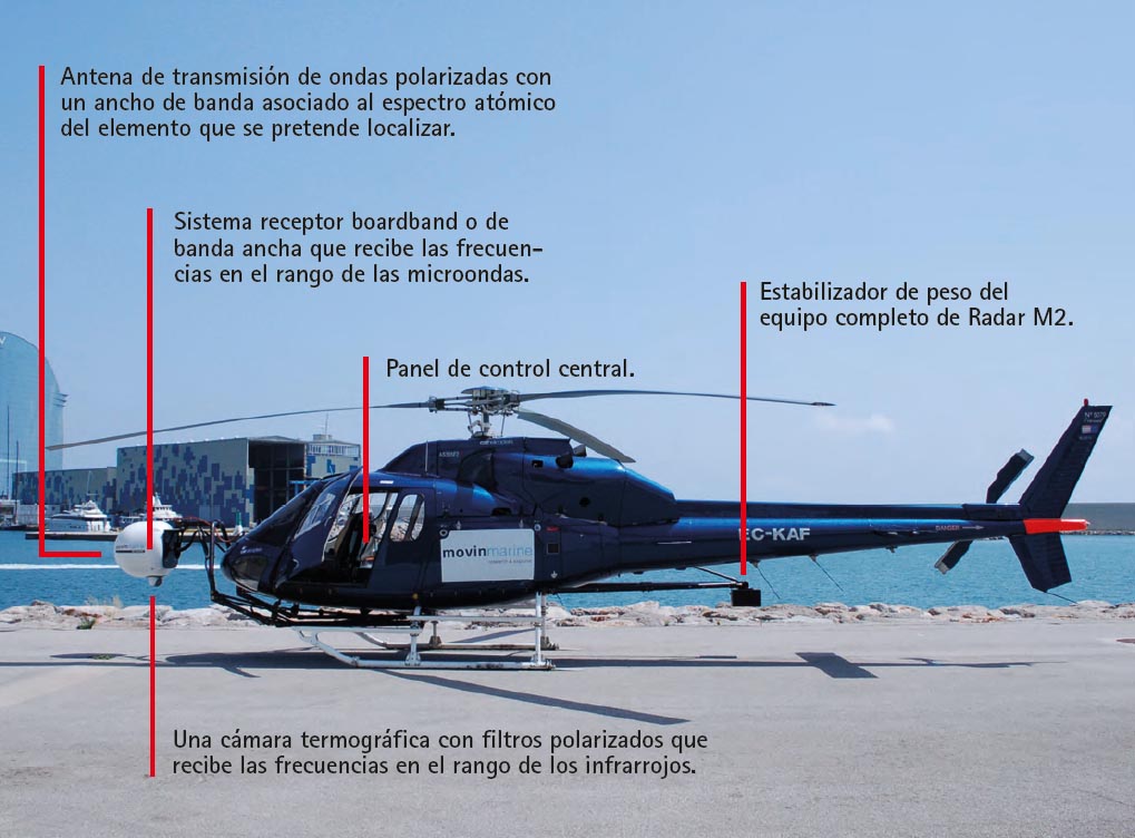
The M2® system includes:
- Three narrow-band microwave radiometric antennas
- A thermal imaging camera to compensate for surface temperature variations
- High-precision GPS and inertial measurement units (IMU) for georeferencing and motion correction
These integrated components allow the acquisition of accurately georeferenced measurements and structured subsurface datasets suitable for advanced interpretation.
How Does M2® Radar-Based Prospecting Work?
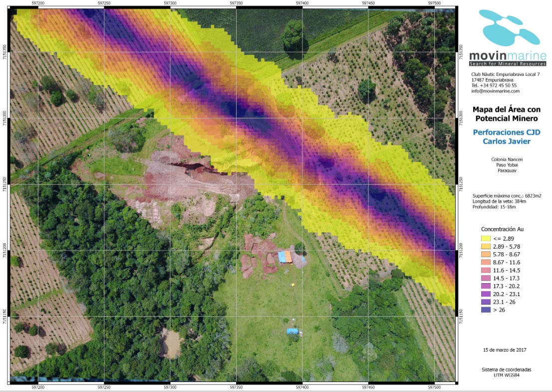
The M2® Airborne Radar system leverages naturally occurring electromagnetic radiation from the subsurface and the reflectance of known signal sources (such as GPS signals) to identify physical anomalies associated with minerals, metals, hydrocarbons, groundwater and buried structures.
By analyzing variations in the dielectric constant and electromagnetic properties of subsurface materials, the system detects contrasts between geological formations — for example, between host rock and mineralized zones — with a high degree of consistency under appropriate geological conditions.
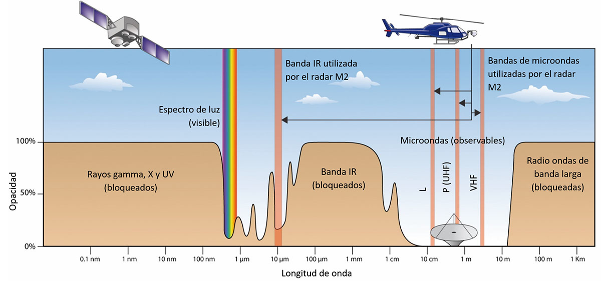
Because the system operates within frequency bands regulated by the International Telecommunication Union (ITU), it minimizes external interference and ensures that received signals originate from controlled or natural sources, enhancing signal reliability and analytical stability.
Technical Specifications and Detection Capabilities of the M2® Radar
The M2® system is optimized for large-scale exploration programs and offers advanced operational capabilities:
- Metal detection (qualitative assessment):
Gold (Au) detection thresholds typically within 0.1–0.5 g/t (under favorable geological conditions)
Copper (Cu) detection thresholds approximately 0.1–0.5% - Survey coverage:
Between 100 and 2,000 hectares per 10–20 day operational cycle, depending on terrain and logistics - Pixel resolution:
~70 meters in natural acquisition mode
Up to 10 meters through advanced post-processing - Narrow-band antenna technology enabling deeper signal penetration under suitable subsurface conditions
- Georeferenced datasets with positioning accuracy of approximately 2.5 meters using integrated GPS and IMU systems
These capabilities make the M2® system suitable for mineral exploration, hydrocarbon evaluation and archaeological investigation, providing structured datasets that support subsequent exploration phases with improved confidence.
Advantages of M2® Radar Compared to Conventional Methods
The M2® system presents significant advantages over traditional exploration techniques:
- Non-invasive operation: no drilling, excavation or terrain disturbance required
- Large-area efficiency: rapid coverage of extensive regions
- Georeferenced outputs: 2D and 3D anomaly mapping for structured interpretation
- Reduced operational timelines: minimizes prolonged field campaigns
- Lower early-stage risk exposure: supports decision-making prior to seismic or drilling investment
This makes the system particularly valuable during early reconnaissance and target generation phases.
Sensor Architecture of the M2® Airborne Radar
Radar systems are generally classified as either active or passive:
Active Sensors
Active systems emit a signal through a transmitting dipole antenna and measure the reflected response using a receiving sensor. These systems are typically used to determine distance, frequency shifts or velocity based on signal return.
Passive Sensors
Passive systems do not emit any signal. Instead, they detect naturally radiated electromagnetic energy from:
- Natural sources (e.g., solar radiation, Earth emission)
- Artificial sources (e.g., GPS, telecommunications signals)
Within passive sensing technologies, sensors that measure naturally emitted terrestrial radiation are referred to as radiometers, whereas sensors that measure reflectivity from known artificial sources are referred to as reflectometers.
The M2® Airborne Radar integrates both radiometric and reflectometric functions within a unified passive sensing architecture.
International Applications and Field-Proven Use Cases
The M2® Radar system has been deployed in mineral, energy and archaeological exploration projects across multiple regions worldwide.
Its application has contributed to scientifically validated datasets and supported strategic decision-making in large-scale international projects.
The technology has been successfully applied in:
- Mineral exploration (gold, copper, rare earth elements and strategic minerals)
- Oil and gas prospecting in both onshore and offshore environments
- Historical and archaeological detection, including shipwrecks and submerged structures
Specialized
Professional Expertise
We are supported by a multidisciplinary team with extensive international experience in advanced geophysical exploration, mining, energy resource assessment and scientific projects. Our operational background includes real-world projects across Europe, Africa and the Americas, collaborating with mining companies, energy operators, scientific teams and international institutions.
The combination of proprietary M2® Airborne Radar technology and expert geophysical data interpretation enables us to deliver reliable, timely and geology-specific results tailored to the unique characteristics of each project.




Request a Technical Exploration Assessment
Tell us which resource you need to locate: gold, copper, rare earths, gas, oil, groundwater, or archaeological remains.
Our international team and Radar M2® technology enable us to deliver fast, accurate, non-invasive results anywhere in the world. We are ready to review your project and provide you with a clear, reliable report.
All information is handled with strict confidentiality.
Perú
Rolando Suaña
(+51) 997122226
rsuana@movinmarine.com
Bolivia
Brasil
Pablo Cejas
+55 31 99258-9886
pablo@movinmarine.com
Spain
+34 972 25 50 92
jcasellas@movinmarine.com